
-
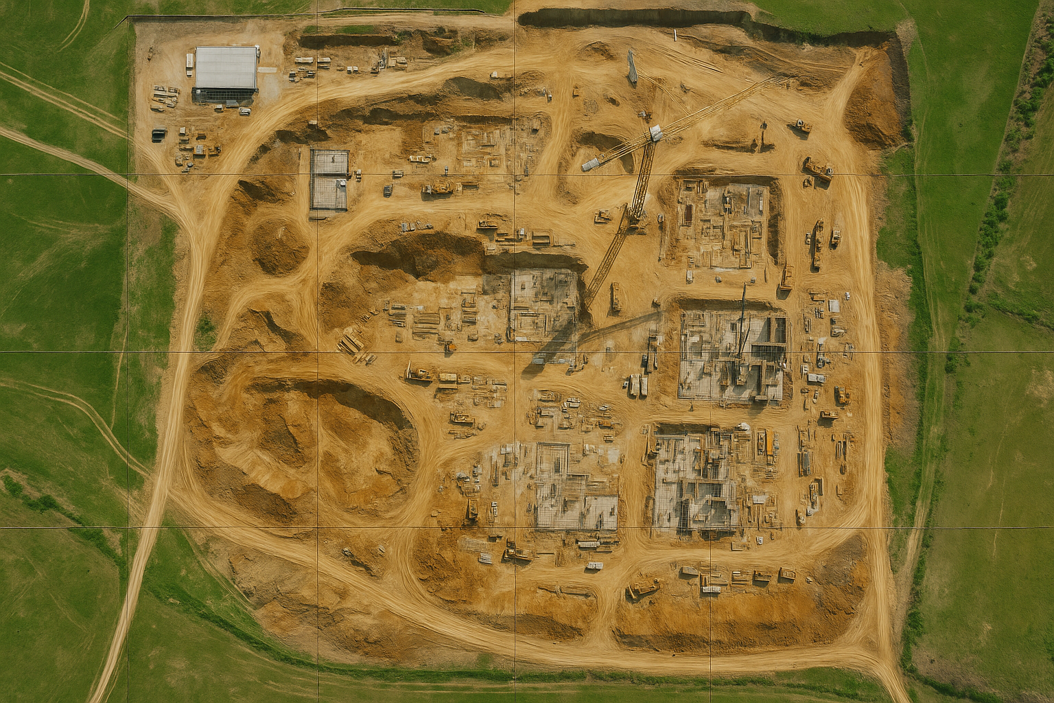
![An aerial view of a construction site with multiple building foundations, construction vehicles, and dirt roads, surrounded by green grass fields.]()
Orthomosaic
An orthomosaic is a high-resolution, distortion-free aerial map made by stitching many overlapping photos into one accurate, top-down image. It’s used for precise measurements in agriculture, construction, environmental work, and more.
-
![A bridge over water with wind turbines on a hill and a digital overlay of a cityscape with green lights.]()
3D Mapping
3D mapping creates an interactive, three-dimensional model by using dense point clouds and mesh reconstruction instead of a flat 2D image. It captures real-world structures with depth, allowing users to rotate, measure, and explore surfaces in ways standard aerial photos or orthomosaics can’t.
-
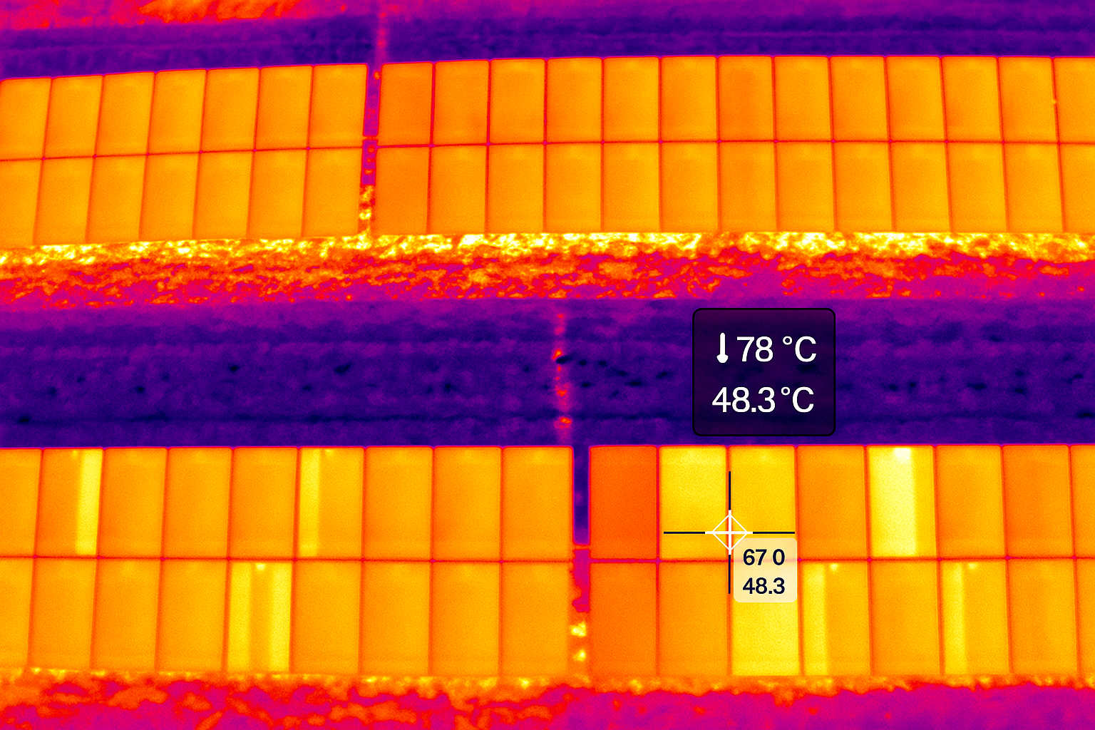
![Infrared image showing a solar panel with temperature readings of 78°C and 48.3°C, with a heat map color scheme highlighting hot and cooler areas.]()
Thermal Inspection
Thermal inspection uses infrared imaging to detect temperature differences that aren’t visible in standard photos. It highlights heat loss, moisture intrusion, electrical issues, and equipment failures by mapping temperature patterns across roofs, buildings, and infrastructure—making problems easy to spot before they turn into costly repairs.
-
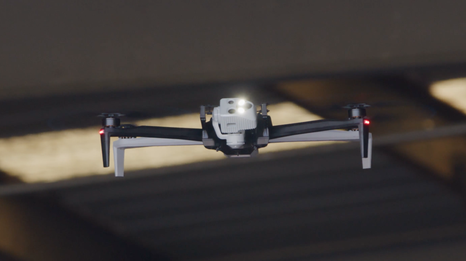
![A drone is flying through a space with dark beams or slats overhead.]()
Infrastructure inspection
Infrastructure inspections using a confined-space drone allow you to assess hard-to-reach or GPS-denied areas without putting people at risk. These drones navigate tight corridors, tunnels, tanks, and interiors while capturing detailed visual and sensor data—making it easier to spot structural issues, corrosion, and defects with far less downtime and no confined-space entry hazards.
-
![Aerial view of a city with a historic courthouse, modern office Building, and streets with parked cars, overlaid with white icons of a drone and a shield, and text about local government UAS & C-UAS consulting.]()
Public Sector Drone Integration Services
This service helps cities and counties build a complete, mission-ready UAS program from the ground up. It covers policy development, training, compliance, equipment selection, and operational workflows so agencies can safely integrate drones into inspections, emergency response, and daily operations without trial-and-error or regulatory guesswork.
-
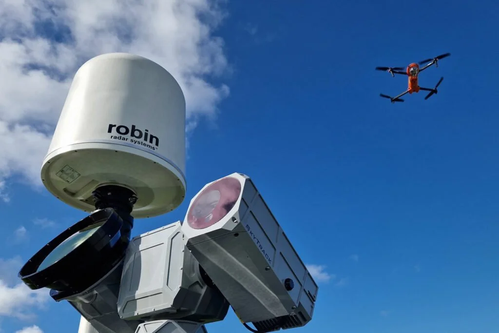
![A radar system with a white dome labeled 'robin radar systems,' a camera or sensor device, and a drone flying in a partly cloudy sky.]()
C-UAS
Counter-UAS consulting provides agencies with a clear understanding of their airspace risks and the practical options available to address them. Instead of pushing hardware, it focuses on assessments, policy development, technology evaluation, and operational planning so organizations can choose the right level of mitigation for their needs—without overspending or committing to tools that don’t fit their mission.


Get in Touch
Tell us a little about your project and what you're trying to accomplish. Whether it's mapping, thermal inspections, 3D modeling, or aerial data collection, we’ll review the details and determine how AeroDatum Technologies can best support your operation.
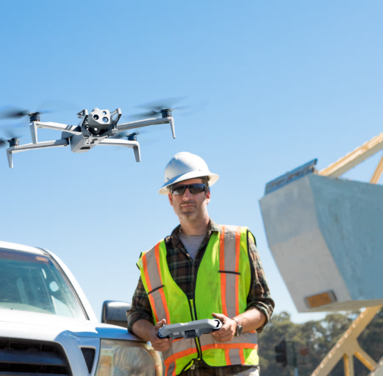
Our Equipment & Data Workflow
We operate with modern, NDAA-compliant aircraft designed specifically for professional inspection and mapping work. Our primary platform is a compact, obstacle-aware system built for tight spaces, GPS-challenged environments, and low-risk operation around buildings, infrastructure, and personnel. The aircraft’s advanced autonomy, onboard sensors, and precision flight controls allow us to capture consistent, usable data even where traditional drones struggle.
Why NDAA Compliance Matters
Many public agencies and industrial clients require or strongly prefer NDAA-compliant hardware to reduce supply-chain risks and ensure equipment meets U.S. security standards. By using compliant aircraft, you avoid hidden procurement hurdles and gain assurance that the platform’s components meet federal requirements for reliability, cybersecurity, and long-term support.
Operational Benefits
Using a modern autonomous inspection platform provides several advantages:
Safe operation near structures thanks to full-coverage obstacle sensing
Accurate, repeatable imagery and video for inspections, mapping, and documentation
Stable performance in GPS-denied areas such as under bridges, next to buildings, or inside facilities
Minimal disruption to ongoing operations due to fast deployment and low footprint
Consistent data quality that technical teams can rely on for planning and analysis
These capabilities allow us to collect the detail you need while reducing downtime, risk, and site interference.
In-House Data Processing for Security & Integrity
All imagery, video, thermal data, and mapping datasets are processed internally on controlled, secure systems. Nothing is offloaded to third-party cloud processors unless a client explicitly requests it.
Keeping the workflow in-house ensures:
Data integrity: No outside handling or re-compression of imagery
Confidentiality: Critical infrastructure, public-safety, and private-sector data stays protected
Faster turnaround: Processing happens same-day or next-day instead of waiting on outsourced queues
Reliable deliverables: Consistent formats such as GeoTIFF, OBJ/FBX, LAS/LAZ, or MP4 based on client needs
From flight planning to final files, the entire workflow is kept under our control to deliver accurate, secure results without the uncertainty of third-party contractors or remote processors.
It all begins with an idea. Maybe you want to launch a business. Maybe you want to turn a hobby into something more. Or maybe you have a creative project to share with the world.


“Traditionally, a lot of our inspection work was really labor-intensive… anything we can do to get people out of those scenarios is where drones have played a big part.”